Total Pageviews

Sunday, August 29, 2010

Day 18: Climbing Mount Whitney


From the summit of Mount Whitney only granite is seen. Innumerable peaks
and spires but little lower than its own storm-beaten crags rise in
groups like forest-trees, in full view, segregated by caƱons of
tremendous depth and ruggedness


30 July 2010

My campsite was eerily quiet all night long. Neither the sound of rushing water nor the pre-nautical chirps of birds were heard. I was up and out and on my ascent to Whitney.

These last eight miles seemed like the longest miles on the entire trek. And I just didn't have much energy. I stopped and rested a lot, looked at the vistas, and took my time.

Two hours into my morning stroll I met the young mother-daughter team I had heard so much about: Heather and 7-year-old daughter Sierra (yes, she was named after these mountains!) passed me on the trail. Sierra seemed delighted to be summit ting Whitney today. Aaah, the joys of youth. Even Heather looked young, perhaps mid-30s at most. She's a second-grade teacher from Bishop who took Sierra on a thru-hike on the JMT when Sierra was just a year old.

This time this was Sierra's first JMT on foot.

I passed the mother-daughter team as they rested near the small pre-alpine lake named Timberline Lake at 10am. They then passed me up for the final time as I rested near Guitar Lake an hour later, the last lake before the three-mile steep ascent to Whitney. It was hot out, and I was worried about water. For the first time in 18 days I worried that my liter bottle, my only water source, would not be enough for the summit and back down again.

I rested at Guitar Lake for an hour, hoping Ryan would catch up with me. I sat up against a boulder and made myself more Asian Curry Chicken, which was really not all that tasty anyway. I sat down and enjoyed the scenery, from watching birds flit about to seeing other hikers pass me by. A ranger and her daughter were on the other side of the rock mass; was she watching me?

Two men on the far side of Guitar Lake had pitched their tents for an ascent tomorrow. One of the men told me that Mount Whitney was "just up that peak, look, you can see the hut from here!" I knew Guitar Lake was a popular place for thru-hikers to rest before climbing Whitney, but it was too early in the day for me to stop; what else had I to lose (besides running out of water?!)

So on I went, slowly. The ascent took me three hours. The views never changed; the view of Guitar Lake rose higher and higher and the higher I climbed, the more of a guitar shape the lake took. I stopped a lot, perhaps at every switchback, because the views never changed. I was going crazy from monotony. I had granitic brown rocks around me and a steep drop in front of me and there was no change in sight.

One man with a much younger partner (son, younger relative?) were the only people who came down the opposite direction during my ascent. The older man was wearing an NFL-AFC grey t-shirt with no hydration pack on. In fact, he looked like he was on a quick descent. "I've been up Whitney seven times" he boasted, "if I were you I'd go back down to Guitar Lake and start up again first thing in the morning!" This man doesn't know my determination. Besides, he didn't look THAT good in shape. Hiking up and down this 13,000' elevation is easier without a 35-pound backpack.

I eventually saw a line of people at one switchback and the closer I got to this the more I realized that what I was seeing is the intersection to Mount Whitney. Alas, there WAS a light at the end of the tunnel! More relieving for me was having other people around me, even if I was the only woman in the crowd.

It was 4:30pm and I was now at the intersection with the peak trail, a 1.9 mile climb to the Whitney cabin. This is where hikers leave their packs for a lighter ascent. Backpacks lined up against the mountain wall and hikers coming and going gathered here. I didn't recognize anyone.

In the end my ascent up Whitney was done alone. There was no Darlene, no Leslie and crew, no Abid, no Ryan and no joyous group hug. I had hoped for that. Instead, I followed a small group that had started ahead of me and finished the trail with them, a group from central Texas who had taken almost an entire day to climb the mountain. They struggled, but for me after three weeks on the JMT, this ascent was nothing, and it felt even better without a pack. I could almost jog again. Fragrant lilacs adorned the trail and attacked my olfactory senses. I didn't expect to see flowers this high up in elevation.

One of the guys was an Afghanistan veteran from Florence, TX. He must have thought I was superhuman the way I was able to move up the rocky trail. Little did he know how slowly the climb up from the mountain floor was for me, too! We chatted a bit, watched two gliders circle the mountain, and took off for the peak.

The sun was in its last rays. I got to the top at 5:50pm, signed the registry and recognized a few other names in the log. Barry had made it up this morning at 5am; I followed almost 12 hours later. I saw no entry for Tom and his sons.

So there I was, on the tallest peak in the lower 48 states. The views were...OK. I was expecting spectacular hues and endless vistas and instead all I saw was a hazy reddish-brown haze across the horizon. I could see Bighorn Meadow distinctively and even Forester Peak, but the rest of the crags meshed into one rocky ridge line across the western horizon.

Oh well. At least I can say I bagged this peak and I have photographs to prove it.

I didn't stay up at the peak for long. I wanted to get back to the intersection before it got too dark. The others from the group were still ascending when I got down; I wasn't going to see them for another three hours.

I had now finished most of the JMT and was ready to walk down in the dark to the eastern base camp. But who did I see when I got back to my backpack? Abid! He had made it up after all! We hugged, laughed, had our picture taken, and soon after that moment the Maryland Three came up. It was another reunion of sorts. I made the spontaneous decision now to stay with Abid at the intersection and to sleep under the stars with him so I could provide him company. We weren't the only ones there.

The Maryland Three spent the night at the summit in the cabin so they could take sunrise photos first thing in the morning. An older man found a sleeping area further down off the trail. We were never alone.

And that is how I spent the last day on the trail: under the stars at over 13,000', huddled in my sleeping bag. Abid was next to me. He told me "bedtime stories" of his life in Pakistan and how his father ended up emigrating to the United States in 1947 and moved to the San Francisco Bay area. It was a fascinating story. He did most of the talking. We sat there, side by side, looking up at the evening sky as falling stars fell down on us every few minutes. I wasn't expecting this celestial show, but these stars were the fireworks celebrating our big accomplishment.

"There goes another star!"
"Oh, and here is another one!"
"Wow!"
"Oooh!"

And that's how we fell asleep, two strangers who met on the trail and who opened up about themselves at 13,000'. Never would I have imagined a sky so brilliant anywhere in California. I could also see the distant city lights of southern California along the southern horizon, and what was probably Reno to our north whenever I went around the corner to pee.

I was expecting to have a cold night, but it wasn't much colder than what I had experienced on the trail. The winds were remarkably calm tonight. I was dressed in my fleece, my rain gear and my hat and as long as I remained bundled in my sleeping bag, I was fine. Abid, however, complained of the cold.

Early ascenters began to come up at 2am so our bliss didn't last. Nonetheless, I will never forget this moment under the stars for as long as I live.

Saturday, August 28, 2010

Day 17: Forester Pass to Wallace Creek

Barry was, as promised, up and out by 6:30am. He was determined to summit Mount Whiteney today, 26 miles away.

I was the second to leave the camp. Ryan opted to sleep in a little, taking it easy today, and Abid was getting up as I moved on.

The hike to Forester Pass was lush, green and steep. It didn't look too far away but once I hit the steep snowpack, I realized this wasn't an easy feat. I saw Barry's silhouette on top of the pass while I was at least a mile away, but the second time I looked up in his direction, he was gone. I never saw him again.

I didn't like Forester Pass. The snowpack, it turned out, had two footprint trails, a lower and a higher one and I ended up somehow on the higher one. Wind gusted strongly, too and I had to focus on maintaing my balance or else I'd tumble down hard on the boulders.

My camera was showing signs of live again, but the photos were still a blur of hues.

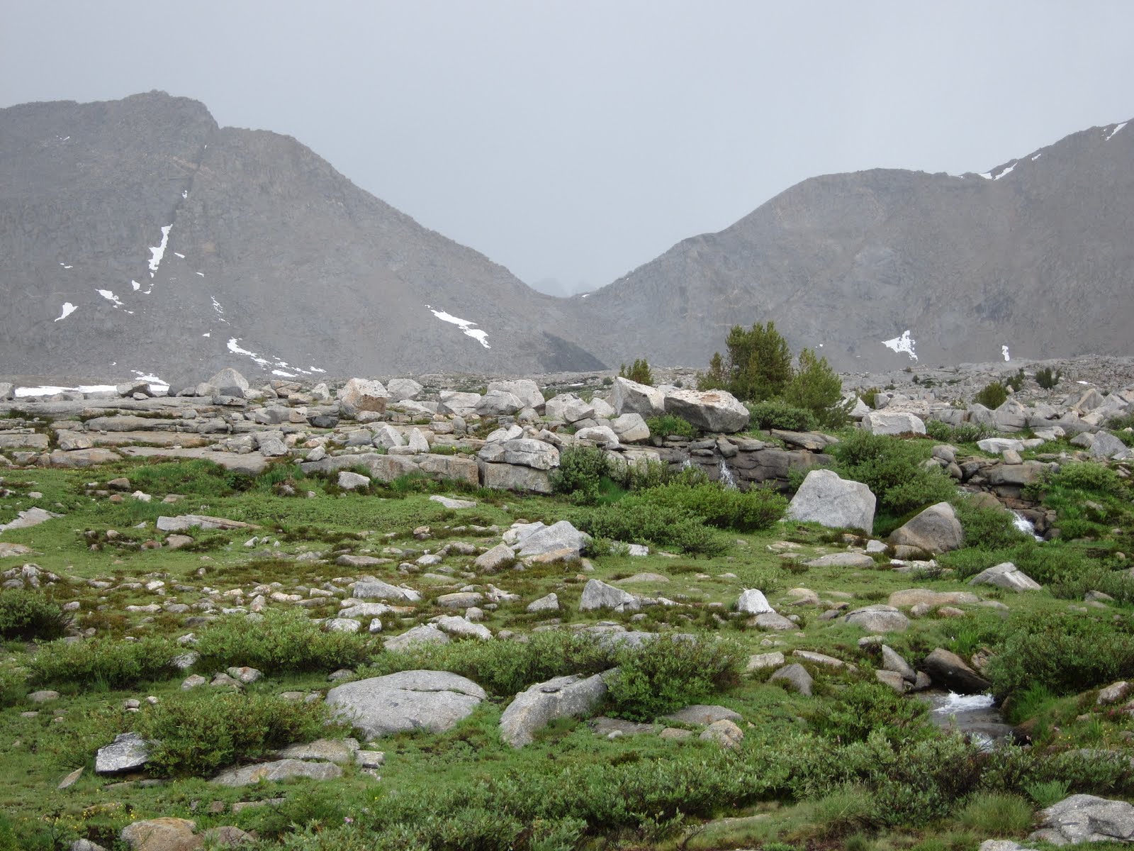
It took me three hours to make it to the pass. I was now leaving Kings Canyon and entering Sequoia National Park. In front of me now was another long, rocky valley of glacial erratics, but this time the peaks on either side showed harsh erosion and long swaths of rockslides. One can see where pine forests here had been destroyed by rockslides.

It wasn't really a pretty view and I wanted to get down from that windy, narrow pass.
This required a long steep switchback downhill that required me to take at least a 30-minute restbreak at the bottom of the pass.

An older man, Leonard, stopped to chat with me. Leonard was a northbounder determined to finish the JMT by avoiding as many people as possible. He had climbed Mount Whitney three days earlier. People, he said, ruined the feelings of solitude for him. I'm sure he would have no problems finding solitude if he kept away from crowded campsites and didn't stop to chat to anyone.

I was exhausted now. I kept stoppping and looking back to see if Ryan or Abid were catching up with me. Ryan eventually did catch up with me perhaps a half mile further, along a fairly level straight-away. We chatted a bit, stopped a few times to wait for Abid, but by 2pm we opted to start prepping for our final day on the trail. With Forester now behind us we had only Whitney to climb, and a directional sign announced Whitney was only 16 miles away.

And then 14, 12...

Suddenly I saw the end of the tunnel. I was going to climb Whitney! Getting to this point wasn't so bad afterall. Now thoughts of getting back to YNP to complete the northern terminus came to mind.

Ryan and I rested along Tyndel creek to wait for Abid. He was still nowhere to be seen. Others were passing us now, some who didn't speak English, and we really had no reason to wait for Abid other than the comeraderie we had developed in the last three days. I liked talking to Ryan, who at 23 seemed so much older and mature than he was.

Friday, August 27, 2010

Day 16: From Rae Lakes to Upper Forester Pass Campground


(All photos by Dough Jones; see link at bottom)


I was up early and was beaten only by another couple starting up Glenn Pass at 6:30am.

This wasn't a bad pass, but it was steep. It didn't have any snow, but what made this pass so tricky is that the top came to a knife's edge: one gust of wind could carry you literarily over the edge, so to speak.

I ended up meeting the couple that had left the campsite before me, Doug and Paula Jones from Seattle. They were an engaging couple and enjoyable to talk to, perhaps because they were both teachers. Some of the most interesting people to talk to are teachers.

Doug, Paula and I leapfrogged with eachother. I was in no hurry and didn't mind their company at all, even slowing down just to talk to them. They took a longer break just before reaching the pass, and that is where I stopped to talk to the large maintenance crew here, a group of young people hired by both the NFS and the California Conservation Corps back in April to restore 600 (!) miles of wilderness trails.

I thanked the group for their hard work. Dough took a photograph of me with the work crew; I was given the honorary title of crew worker as I was given a shovel to hold.

(I'm still waiting on that photo from Doug as I write this).

Others from below started catching up with me. The pass was not that big for all of us, so I continued on the descent, a steep and long trek down into a long, steep canyon. I was now officially off the last map sheet I had.

This link contains some photos that Doug took of me, Leslie and her family, and the area around Rae Lakes.
http://jones-seattle.org/Hiking/2010-7_Rae_Lakes_Loop.html#37


TBC

Thursday, August 26, 2010

Day 15: From Forester Valley to Rae Lakes


Nature is always lovely, invincable, glad, whatever is done and suffered by her creatures. All scars she heals, whether in rocks or water or sky or hearts. JM

(All photos today were taken from Doug Jones, Seattle)

26 July 2010

The Asian rice I had left overnight for the mice was gone in the morning. A few (well-fed!) mice flitted around me in the morning, where I took my time with breakfast of oatmeal and cocoa. I even spoke to the mice as if they were my campmates. When I left to start my hike near 8am, I said "good-bye" to them. I had spent 24-hours of complete solitude and was ready for human interaction again.

Today's hike toward Rae Lakes was a pretty hike. I was approaching the end of the maps I had so I took advantage of any details. I hiked another mile before I crossed the raging creek, walked over a hanging bridge (which gave me the jitters) and was now in the long upgrade. I walked slowly as I was in no hurry. I was still two days ahead of my 31 July exit date and from what I figured, would be off the trail by the 28th.

Several people passed me by, from an older father-son couple and a mother-sister-dughter group. One of the older women even asked me "Are you Connie?" They had met Tom and the boys a few days ago and Tom apparently told them I was retired army and hiking with a red backpack. So it was my red backpack that gave me away.

The woman who spoke to me first was Leslie, a former Navy officer (nurse) who now teaches nursing in Springfield, IL. Leslie was hiking with her sister Debbie from Boston and her daughter Michelle, who had served eight years in the Marine Corps and was now transitioning into the civilian world. The three women had seen me standing on Mather Pass. Michelle, the group's photographer, showed me the photo she took of me. There I was, a blur on top of Mather Pass, looking down into the valley. I remember that moment. I was watching two groups of three people walking in the valley, realizing that to get to that point where the people were required a long, steep downhill, and there were storm clouds to the south. The faster group of three people now I realize was Tom and the boys.

I ended up spending the rest of the day with Leslie, Debbie and Michelle and joined them for lunch at Dollard Lake, a small aquamarine lake nestled with pines. We talked a lot about military events, from Marine and army stuff to contemporary issues. It was my first intense conversation I had had on this hike, and my first deeply-political conversation. I hadn't discussed politics at all during my trek so far; politics don't belong in the pristine wilderness, but today it seemed quite natural with so many veterans in the group.

Leslie and Michelle ate their meal. I only had a Fruition bar as I wasn't hungry. I sat there with the gals on a warm rock and had no worries about how far I was going to go today. Michelle, the group's planner, had the entire trip mapped, profiled and scheduled. In the Marines she was a logistician. She planned daily treks of six to eight miles, and today's goal was Rae Lakes. I made it my goal as well, because anything after the lakes required a steep uphill over Glenn Pass.

We leapfrogged all afternoon. I'd hike on ahead, then wait for them to catch up with me. Debbie had trouble with the uphill so Michelle had to slow down for her mom and aunt. I stopped on my own; I just didn't have the speed anymore I had a few days earlier, before my dunk into that swollen creek. Today I focused on human contact.

This stretch was a scenic stretch and full of people. I hadn't seen this many people on the hike since the Red Meadows area. A large Boy Scout troop came the othe way as I approached a wide but shallow creek. I managed to cross it by hopping on rocks and dipping my boots into the water. The troop watched me cross, thanked me for "Showing them how to do it" and followed my footsteps in the opposite direction. Other people on the other side of the creek had taken off their shoes to cross. I guess I showed them, ha. (But little did they know that a few days earlier I had gotten a life's lesson on creek fording!)

The valley wasn't as steep as I had thought it was. On my Harrison map this looked long and steep, but in reality the eight miles was quite doable. Although mostly uphill, there were some pleasant rock boulders that jettisoned from the ground to provide interesting formations as the trail meandered around, over and through rock outcroppings before ending at Rae Lakes.

As soon as I crested into the northern part of Rae LAkes, a combination of several smaller lakes surrounded by high peaks, I smelled a wildfire. The breeze had carried what was clearly the smell of trees burning over Rae Lakes, giving the sky a light brown and hazy appearance. No one else seemed to notice the smell but me. I was worried...had the recent storms ignited a fire somewhere? Was the JMT in danger of closure? Would southbound hikers be forced to exit the trail? Was I the only one concerned?

I asked other hikers along the trail. No one even noticed the smell of wildfire. The ranger station at Rae Lakes was closed, although the ranger's uniforms including underwear were hanging in the back of the wooden cabin to dry. The ranger was on patrol somewhere and would be "back later."

Rae Lakes, it turned out, is a popular destination for those on three-to-five day backpacking trips. Two large church groups had already claimed some of the best real estate along the lakes by the time we arrived in mid-afternoon. I would call this area "congested" and "lacking privacy" although I could have sworn there was a group skinny-dipping to a small island in one lake and then racing back to shore.

We met the local ranger here, an older, tall, thin man with a ZZTop-like beard. He had just come down Glenn Pass. He wasn't interested in cheking our permits, and most of us had our bearvaults out so he didn't mess with that either. I asked him about any nearby wild fires.

"There's supposed to be a fire somewhere in the Sequioa National Forest, but they don't tell us much else!" he said, and walked on. So I was right, I did smell a fire and others around me were amazed I had gotten a whiff of that.

Leslie and the gals were camped across the trail from us. We took the afternoon off to do personal hygiene. I wanted to have clean clothes to look presentable once I exited the trail at Kearsage. The long nylon pants I had taken on this trip proved to be comfortable and useful, but the off-white color made them very fragile to any and all dirt.

But was I still going to exit at Kearsage now? My feelings kept wavering, from going all the way to Whitney to getting out at Kearsage. My mood since my water baptism kept changing, and today's energy level was down again. I enjoyed the time off to relax at the lakes and socialize.

My spot was on a bluff, the last (or first, depending on one's direction of travel)on the lake before climbing up Glenn Pass. I took a spot in the corner of the open area so others could pitch their tents near me; there was room for three more.

Leslie invited me to join them at 6pm, so I joined the gals for a nice dinner. More people came to Rae Lakes, including two younger men who I met later as Barry and Ryan. By 7pm three more people showed up, and one of them was Abid. It turned out that Leslie and the gals had met him, too and thought he was funny.

"ABID!" I yelled out. He recognized me right away, but he also recognized Leslie and the others. With him were John and Stacy, a young couple who were known to prepare gourmet meals at night (John claimed he was carrying 35 pounds of "wet foods" just to keep Stacy happy)

Slowly the campsite became a happy reunion site with hugs, laughter and lots of picture-taking. Abid loved the attention.

More later...

Wednesday, August 25, 2010

Day 14: From Bench Lakes to Forester Valley

The rain continued all night, from midnight with lightining and thunder, to 5am rain showers. The day wasn't starting out very nicely.

And there I lay, despondent over my situation. I stared at my camera, wishing I could just get beamed up and out of this wildnerness. What good was it for me to be out here with no way of recording the scenery?

One thing that kept me from losing all sanity was being able to stay warm and dry enough overnight. The last pieces of clean, dry clothing came in handy!

When the sun finally rose, though, I was in no mood to continue my trek. I couldn't go anywhere with the wet and heavy backpack and my damp clothes. I had to dry out everything I owned, and I needed a place to dry out my stuff in relative privacy.

Oddly, there were few people I met on this section. I packed my tent as soon as I could (risking getting a fine for being too close to the trail). The trail took a nearly immediate ascent, and it was all too much for me. I was heavily weighed down, tired and still in a despondent mood. I opted instead to write off today as a zero day until my gear dried out, but that didn't look too promising with overhead grey clouds moving in.

Twice I spread out my clothing on branches off the trail as I just sat and waited. I had nothing to read, nothing to photograph but the scenery in my mind. Two men came down the trail but didn't say much nor was I in the mood to chat much anyway. When the sky looked like it was going to rain, I packed up all my gear and slowly continued on.

But it didn't rain, and once I was in a level valley with Forester Peak ahead of me, I again unpacked my wet gear and again spread out my stuff to dry. And again it drizzled for a bit (making me quickly get inside my tent) but this time the drizzle was soft and short. I finally decided I had no choice but to move on, to slowly make it as close to Forester Peak as I could.

Tuesday, August 24, 2010

Day 13: From Lower Palisades Lake to Bench Lakes and a quick dip in a creek


Only in the roar of storms do these mighty solitudes find voice at all commensurate with their grandeur. . . . The pines at the approach of storms show eager expectancy, bowing, swishing, tossing their branches with eager gestures, roaring like lions about to be fed, standing bent and round-shouldered like sentinels exposed

25 July 2010

A full moon was setting as I got up at 5:15am. This was the moon I was hoping to photograph in its prime, but the storm had nixed that idea. The morning sky still had hues of storm colors: rippling high cirrus clouds swept across the horizon. Clouds to the south looked darker. Rain was not something I feared today. My priority was getting over Mather Pass.

I was up and out early as no one bothered me. Sure, it was cold in the morning at the high elevation, but so peaceful. The lake's surface sparkled like smooth glass, there was no motion. My tranquil thoughts were only interrupted by what I knew was ahead of me today: Mather Pass and more snowbanks. The pass was visible from the Upper Palisade Lake, and there were still a few miles to the peak.

I ran into Tom and the boys at the upper Palisades Lake. It was 7:30am by then and surprisingly both sons were already up. I stopped and chatted with them while Ross was still packing his pack, and then took off with them.

But the camaraderie didn't last: as soon as the sons were up, the threesome was gone. And I was in no mood to keep up with them. Although I saw them a few more times from a distance, this was the last I was to see of them. There was no good-bye, no promises of keeping in touch...nothing. They were just another set of people I met in the wilderness. It was better this way, as I sensed Grant was annoyed with me and wanted to lose me.

It turned out to be a not-so-pleasant day for me. I saw the threesome bag the pass at 9am. I followed 50 minutes later, slowly climbing up a steep and precarious and snow-covered switchback that was starting to soften in parts. Fear of falling through the snow, of sliding down the ice or of getting trapped in a rock slide tormented my mind. Had something happened to me I would have been on my own. I stopped a lot to catch my breath, enjoyed the vista and prepared for the next climb.

The pass was a long pass to ascent. When I got to the top I saw the three guys in the valley, getting further away from another group of three on the same trail. Who were the other three? I sat at this pass, relieved in a sense that I would most likely not see the boys again, and prepared for the long descent. Dark storm clouds moved in from the south and lighting struck distant peaks. I had no doubt I would get caught in that storm and I didn't want to be up high when it struck.

The views weren't all that spectacular from the pass as the valley below was another lunar landscape of glacial erratics, moraines and winding creeks. A long and narrow timberline was further away. Could I make it that far before the storm?

No. I was still a mile away when I stopped to put on my Marmot Precip gear at 11am. I barely had my pants on when it not only began to rain, but hail as well! This time I didn't have time to get out my tent fly, and huddled low. This time the storm only lasted 20 minutes and when I was sure the worse was behind me, continued my hike in the rain. My rain gear kept me warm and dry!

It drizzled for the most part for the rest of the afternoon. I still stopped along the way to rest, not minding the cool refreshment. Everyone was out in rain gear, including a work team of young college students out taking samples of soil and water. Parts of this timber forest reminded me of a rain forest, it was lush green and damp.

I wanted to get as far as I could during daylight before pitching my tent and calling it a day. I had perhaps made at least six miles, though, when I crossed the swollen creek before the ranger station. The creek was wide but not too deep and heavily snagged. I crossed the first fork effortlessly but during the second fork, with one foot away from terra firma, I slipped and was pulled back into the water. Oh no! I quickly tried to pull myself back up but the current pulled me down. I was now almost completely submerged with only my head and left shoulder free and dry. I didn't scream for help although there was a small crew just ahead of me that had crossed at this spot; they had no idea I was just behind them a few steps.

My baptism couldn't have lasted but a few seconds, but that is all that it took for me to get wet and be heavily weighed down. I managed to grab on to a snag and pull myself, then drag myself out of the creek. The sky had opened up with a small patch of blue, and I just stood there, dripping wet and standing in disbelief. My worst fear had come true: I had fallen into a creek.

But what was even worse was that my Canon S90 which was in my jacket pocket but not safely in the plastic bag, had gotten submerged. The lens had extended out. The battery case seemed dry and there was no obvious damage to the camera, but the extended lens bode badly.

When I wiped the inside of the battery compartment down and put in the battery, the camera still refused to work. My camera had been ruined.

Now all joy was lost. I was wet, heavily weighed down, my camera ruined and the day wasn't done raining. My only goal now was to find a place to pitch my tent.

I found a small sandy patch not to far from the creek. Although it was close to the trail and I was able to hear passersby, I didn't mind. If a ranger was going to force me to move, hopefully he would have the compassion to understand my predicament. Surely the rangers in Kings Canyon weren't the assholes they could be in Yosemite?

It was 1:30pm when I found a site, got in, took off all my clothes and put on the last two remaining clean and dry articles of clothing: two long-sleeved therma tops meant for cooler nights. My nylon pants were damp but not wet; they became my jammers for the night. I cooked a meal inside the tent and never showed myself for the rest of the day. It stormed the rest of the day, sometimes fiercely, and it would have been a rest day anyway had I not fallen into the creek.

I huddled in my sleeping bag feeling totally despondent. Just yesterday I had dreams of getting to Whitney, today I just wanted to call for a helicopter to gt me out of this hellhole. What made this especially frightening is that no one knew, no one say my predicament. Had I died I would not have been missed (right away) and had I died in my sleep no one would have noticed it right away.

I heard two more groups of people hike past my tent. My clothes didn't have a chance to dry. Next to me was my camera and the sight of it depressed me. My $346 camera was ruined and I had no way of recording the rest of the journey. A severe feeling of helplessness overcame me. I am glad I was alone as I would not have been happy company.

Monday, August 23, 2010

Day 12: Little Pete Meadow to Lower Palisades Lake


It is not long, geologically speaking, since the first raindrop fell on the present landscapes of the Sierra; and in the few tens of thousands of years of stormy cultivation they have been blest with, how beautiful they have become! The first rains fell on raw, crumbling moraines and rocks without a plant. Now scarcely a drop can fail to find a beautiful mark: on the tops of the peaks, on the smooth glacier pavements, on the curves of the domes, on moraines full of crystals

None of Nature's landscapes are ugly so long as they are wild


24 July 2010

I didn't want to get up. Yesterday's long hike had drained me, and today was no different. I found I was hiking just to keep up with Tom and the boys, when in fact what I preferred was hiking completely at my own pace. I couldn't keep up with the pace for the rest of this hike, but I decided to use this opportunity to challenge me physically. Tom kept telling me how he and his sons are impressed with my pace; I felt, however, that they overestimated my abilities. Or did they?

I left camp at 7:08am. I waved at Tom who was already up and continued on the downhill hike to the next intersection into Mather Pass. It took longer to reach this intersection, which means we didn't get as far south yesterday as we had thought. More deer spooked me along the trail, and more wet trail passages detoured me off the path. I hadn't seen so many deer as I had this morning, browsing right off the trail.

Part of the lower trail were very muddy or flooded with water. At one point I slipped on a pointed rock and bruised my tailbone on the right butt cheek. Ouch! That made stepping up rather painful, and I was using my left leg to compensate for the injury.

There were several older couples coming from the opposite direction, warning me of the snow conditions up Mather Pass.

I just didn't feel my MoJo today. Despite my many rest breaks, I felt exhausted. It was also a hot day. The lower valley up Mathers Pass was an exposed valley, having experienced a brutal fire here that took out most of the mature trees. Many of the dead trees still littered the trail, which at times was no wider than a foot long and overgrown with meadow grass. (The grass reminded me of a bad hair transplant). If I had to pick the least scenic stretch along the JMT, it would be this burned section in the valley.

The one opportunity I had to take a break from hiking and jump into cold water was quickly ruined when, out of nowhere, a grandfather-father-two grandsons group came up from behind and took over my rest spot. One of the young boys got completely naked in the water. The group didn't seem to care that I was nearby and waiting to get into the water, too, if only to get some water for my bottle. I was not in a good mood as my brief privat moment had been interrupted.

My bad vibes must have been felt by the group and they quickly left, never to be seen again. It turns out this family was out hiking the entire JMT and would pass up Tom later.

Tom and the boys passed me up shortly after noon, where we had lunch together off the trail. Once they were on the path again, I lost them. They were simply too fast for me and I let them go; I didn't want to be the "fourth wheel" interrupting their family time. Grant was especially restless to get the JMT over with. He wanted to get back to Indiana and see his new Ford Fiesta Dad got for him.

Oddly enough, what started out as a hot and humid hike quickly turned into a wet late afternoon. I trudged along the trail as it slowly moved uphill. The grade wasn't bad, it's just that the trail was exposed for most of the way. To top things off, I still had to conquer "The Golden Staircase" leading up to Mather Pass, a long 1500' high staircase made of natural rock.

Somewhere in the lower stairs I was hit by a rain and thunderstorm. What could I do besides get into my rain gear and use my tent fly as additional rain gear? I huddled low off the trail while pea-size hail pounded my back. A lone hiker dressed in African safari gear (rather odd-looking attire!) came down the stairs, disappeared briefly off the trail to put his rain gear on, and continued his trek downhill with "Have a nice day!" That comment seemed superfluous considering the storm I was in; it made for anything but a nice day.

The storm lasted only 30 minutes, but it brought with it a swath of mosquitoes I hadn't seen yet on this hike. These bugs were relentless! I climbed slowly up the staircase, passed the appropriately-named "Deer Meadow" where a wet doe stared me down, and arrived at the first of two Palisade Lakes. Storm clouds still lingered, but now the fading sun painted the sky with soft pastel colors as sundown soon lingered.

I took the first campsite I found near this lake. I was again surrounded by solitude. Mather Pass was still at least two long miles away. All I could see was the sub-alpine lakes and flora around me. No one else was around.

Sunday, August 22, 2010

Day 11: Upper McClure Meadow over Muir Pass to Little Pete Meadow


Who publishes the sheet-music of the winds or the music of water written in river-lines?

23 July 2010

Today's hike started out with a long and steep switchback uphill through pines to Evolution Lake. It was a slow and painful climb. But once at this lake the sheer alpine beauty opened around me: aqualine blue lakes surrounded by snow-capped peaks in all directions. There was plenty of snow and rushing water all around. There was hardly another soul for the first two hours while the sun slowly moved up over the peaks to light up the ground. Hiking in the shadows was cold but refreshing and I wanted to take advantage of the early solitude.

I was now at a high-elevation lake, the last big one before ascenting Muir Pass. I had heard so much about Muir Pass and this year's snow pack, that Darlene had gotten me nervous about this area two weeks ago. We heard horror stories about there being "four miles of snow pack" or to be "extremely careful not to fall through the melting snow." Now I was approaching the pack and regardless of the snowpack, I was not turning back. I was going to climb the pass and get down the other side.

Water here was fast but clear. The first people I met was an English endurance couple who had started at the same time as I did this morning, but were lower in McClure Canyon. They hopped across the rushing creek with ease. Both were slender folk dressed in running gear. I lost sight of them a mile up the road.

Once the sun came up over Evolution Lake, people came out as well. A mother-daughter PCT team passed me the other way. They had been on the trail since April, but had to take several weeks off at a time because the 13-year-old daughter was still finishing her school work. A peruvian father and his adult daughter were behind me. Two other young men were going southbound. There was a lot of traffic near Muir Pass.

I also got to meet Ranger Dave Gordon. A tall, slender older man wearing his ranger hat and backpack, this was his turf, and apparently this is also his favorite park of Kings Canyon. He was out checking wilderness permits and asking how we were storing our food. He's been patroling the area for 18 years. I told him my story about losing Al and Then Darlene. I wanted to know if I could get my permit's exit changed from Kearsage in Onion Valley to Whiteney Portal. With a troke of his pen, he did just that. He signed and dated my permit. It was that easy! Now I could continue with ease with Tom and the boys all the way to the southern terminus. Or I could continue on alone and meet other people along the way. A big headache was lifted from my shoulders as I considered getting off the trail, hitching back to the permit office, and returning at Kearsage to finish the southern end of the JMT.

Getting over Muir Pass, though, was more difficult than I thought. The lower trail was hard to follow as it meandered around large boulders that obscured the view. I did a lot of rock hopping off the trail before I saw other people below me along the lakes. I was so worried about getting lost here, but even that fear was unfounded.

I met an older Pakistani hiker off the trail. A friendly chap, he was more of a philosopher. I told him I was afraid of losing the trail. "Don't worry, just use common sense!" he said. He was right. I was going to meet up with him again at the Muir Hut. His name was Abid.

It wasn't so much that the snow was long and hard, it's that there was nothing else along the way to keep me occupied. Snow was all around me and it slowed everyone down. The snow didn't slow several birds, ladybugs or spiders though.

I made it to Muir Hut right at noon. Several other hikers were already there enjoying their lunch. Two couples were getting ready to leave and several more were about to arrive. Two marmots, just as mentione in the Elizabeth Wenk book, stood guard at this hut that was built by the Sierra Club in 1932 to provide emergency shelter for hikers caught here in a storm.

Abid came up an hour later but didn't stay long. He looked around and quickly descended.

"Aren't you going to stay for a while?" I asked him.
"What for?" and with that he was gone, descending the other side.

His answer made sense. Why bother hanging out at the cabin? There was only so much to see, although I found the long swath of white snow in either direction rather hypnotizing. But Abid had another goal, as I learned later, and that was to hike for as long as he could every day, taking breaks only to smoke or drink tea. He was the only smoker I met on the entire trail.

Muir Pass on the south side proved to be a dangerous but beautiful area. Icy snow was still piled up high here, and sections of snow were melting and precariously hanging over rushing water. It wouldn't take long for someone to fall through this snow pack, perhaps in two weeks. The canyon coming off Muir Pass was a narrow canyon, and several lakes formed as the elevation descended. The snow and rocks slowed me down. I caught up with Abid a few times and chatted with him, yet when he took another tea break I lose him for the evening.

Despite the dangers around the melting ice, I found this canyon south of Muir Pass quite beautiful. Wanda Lake, the first large lake south of the pass, still had ice sheets on its surface. It was the last lake in the High Sierras along the JMT to thaw. Wanda was one of Muir's daughters. This area is an area I would have liked to have seen without the snow and ice. There was much life here, including a hardy species of frog that hopped across the still-snow trail. I didn't expect to see amphibians this high up in elevation, but the frogs surely weren't expecting a late and cold spring this year. They were reproducing on schedule as they had been for millenium.

"The frogs have to adapt, just like we do" said Abid. I stopped to photograph the frogs while he thought I was being silly stopping to watch the critters hop around. No where else along the trail had I seen frogs.

I lost Abid here once I got ahead of him while he took another smoke/tea break. The lower in elevation I got, the more lush my surroundings became. I liked this stretch, in fact, the entire section today was beautiful. My only complaint was that both of my feet were badly rashed from the duct tape I had put on both feet at Muir Ranch to prevent blisters. The wet boots today irritated the feet which rubbed against the tape.

The descent from Muir Pass continued on for many miles and I never made it down to the level ground. Tom and the boys caught up with me at 4:30pm and an hour later we were camped along the creek with a huge boulder that resembled a dinosaur's head. The boys had gotten the little level ground there was. To preserve their privacy, I pitched my tent on a small slant closer to the trail. I washed my hair, washed my blue blouse, had my Mountain House meal, and called it a night at 8pm when the boys were still out doing their father-son talks.