Total Pageviews

Friday, June 26, 2020

Powerwalk around Lake Fayetteville; Eureka Springs in

It was 71F at 5am when I got up and I was already sweating. I got to a lake parking lot and started walking clockwise. I was so impressed to see so many people out jogging, running or cycling. 

The entire trail is a paved trail. Wildflowers hug the sides of the trail. I smelled sweet honeysuckle for most of the two hours I was on this trail.Y only disappointment was having little view of the lake..

The official start of the trail is at the Veterans Park on the SW part of the lake. The best view of the lake is 0.3 Mike north of the park, as one crosses the dam. 

Sunday, July 3, 2011

The JMT has been cancelled this year

The eastern Sierras continued to get record snow falls all throughout June. Lake Tahoe's last snow fall was 29/30 June!

PCTers who posted trail reports left behind grueling reports of their miles and miles of postholing across ice and snow-covered passes. One even reported of falling into a swollen creek, which brought back nightmares for me. None of the reports sounded like fun, and none certainly were enticing enough to want to jump on the JMT for another round.

There was no let-up in the snow, ice and freezing rains. It even broke Mary in the end.

Mary and I have kept in contact nearly daily these last two weeks and we have agreed to cancel our reservations for July 5th. Other things have come up as well that have delayed our start for meeting up, but we still plan on getting together in Lone Pine by the 9th for several day hikes. She has several good ones planned, all leading to alpine passes in the Inyo National Forest, which means my dog Sadie can join me! This will be a delight. I really don't want to deal with pesky National Park Rangers anyway (the only mean ones are in Yosemite).

I am still planning on leaving Arizona on the 5th for some travel time, taking the same route as last year to get there, stopping in Palm Springs and San Bernadino. This time, due to severe floodings in the upper eastern Sierras now, I'm taking my Ford Escape instead of the roomier van. It will be crowded having Sadie with me, but at least I won't get pulled over for driving a suspicious-looking smuggling van.

Friday, May 27, 2011

Record snow fall in the Sierras

I'm watching this. Last year the Sierras had snow in late May and resorts were delayed in opening for two weeks. If there's as much snow in July when I get there I won't mind, but anything more will make the backpacking trip an arctic expedition.


Heavy snows spoil weekend holiday plans in West
By STEVEN K. PAULSON, Associated Press Steven K. Paulson, Associated Press
Fri May 27, 5:26 pm ET

DENVER – Ski resorts are bustling with activity. A key highway into Yellowstone is closed because parts of the road have seen more than 25 feet of snow. And campgrounds are feverishly removing snow from campsites to clear the way for visitors.

Welcome to Memorial Day weekend in much of the West.

The traditional kickoff of the summer season will have a decidedly wintry feel in the Rocky Mountains, as well as California's Sierra Nevada, because of a lingering record snowfall.

Epic snowpack in parts of Colorado, Utah, Wyoming, Montana, Idaho, Oregon and California is forcing many tourists to abandon the annual rites of launching their summer holidays with a camping trip. Others plan to take advantage of prolonged skiing and snowshoeing this strange spring.

Yellowstone National Park has just one campground open. "We're telling people to be prepared for snow," said park spokesman Al Nash

In other parts of Wyoming, officials have extended winter closures of wildlife management areas to campers. The reason: To protect wildlife from humans because animals are still searching for food at lower elevations.

The Bridger-Teton National Forest Avalanche Center is fully staffed to warn outdoors enthusiasts.

"May snow depths are deeper than anything we have seen in the last 45 years," said avalanche center spokesman Bob Comey.

In California, a historic Sierra Nevada snowpack is making Yosemite National Park's springtime cascading waterfalls especially beautiful — and dangerous, with several accidental drownings already of people who failed to keep away from thundering waterfalls and swollen creeks and rivers.

But snow has kept rangers from installing a cable railing that helps hikers maintain their footing at Yosemite's iconic Half Dome. Anyone holding one of the allocated permits to climb will be out of luck this weekend.

"That was the caveat when people signed up — you may be out of luck depending on the snowmelt," park spokesman Scott Gediman said.

Park officials instituted the permit system last year to limit traffic to 400 people a day. Best guess is that the Half Dome route could be open by June 5, Gediman said.

Farther north, some popular campgrounds in Tahoe National Forest aren't expected to open for several weeks.

"We're still selling backpacks, because people are still geared up for the season," said Jeff Dostie, a clerk at Alpenglow Sports in Tahoe City, Calif. "But they're buying for the future, they're not buying for today."

While the snow is bad for some campers, it's great for skiers in Colorado and elsewhere. Aspen is reopening 136 acres of trails for skiing this weekend, and Arapahoe Basin has extended its closing dates beyond June 5.

"We're getting amazing ski traffic for this time of year because of this snowpack," Dostie said of the conditions in the Lake Tahoe region along the California-Nevada border.

Monday, May 16, 2011

Winter storm in the Sierras

Reading this has me a bit concerned now. We are already at record snow depths in the high Sierras, and continued more snow will make this July's backpacking trip more of a snow adventure, something I doubt I will really enjoy.

Sierra Nevada from Yosemite to Kings Canyon
Winter Storm Warning
Statement as of 10:44 AM PDT on May 16, 2011

... Winter Storm Warning remains in effect from 11 PM this evening
to 11 am PDT Wednesday above 6000 feet...

A Winter Storm Warning above 6000 feet remains in effect from
11 PM this evening to 11 am PDT Wednesday for the higher
elevations of the southern Sierra Nevada.

* Another round of potentially dangerous winter weather will
arrive in the Sierra this evening and it will persist into
Wednesday.

* Snow accumulations: up to two feet or more of snow is
possible above 8000 feet... 10 to 18 inches above 6000 feet.

* Timing: snow will begin this evening... then continue heavy at
times well into Wednesday.


Bishop, CA Weather Advisories, Watches & Warnings

WINTER WEATHER ADVISORY
in effect until Tuesday, May 17, 10:00 AM

...WINTER WEATHER ADVISORY REMAINS IN EFFECT FROM 5 PM THIS AFTERNOON TO 10 AM PDT TUESDAY...

A WINTER WEATHER ADVISORY FOR SNOW REMAINS IN EFFECT FROM 5 PM THIS AFTERNOON TO 10 AM PDT TUESDAY.

* TIMING: SNOW WILL INCREASE LATE THIS AFTERNOON AND BECOME LOCALLY HEAVY AT TIMES OVERNIGHT BEFORE TURNING TO SHOWERS TUESDAY MORNING.

* SNOW ACCUMULATIONS: 4 TO 8 INCHES ABOVE 7500 FEET...ESPECIALLY WEST OF HIGHWAY 395...WITH 1 TO 4 INCHES ELSEWHERE.

* IMPACTS: SNOW COVERED ROADS WILL MAKE TRAVEL HAZARDOUS MONDAY NIGHT INTO TUESDAY MORNING WITH VISIBILITIES LESS THAN 1 MILE AT TIMES.

PRECAUTIONARY/PREPAREDNESS ACTIONS...

SNOW WILL MAKE ROADS...BRIDGES...AND SIDEWALKS SLICK AND HAZARDOUS. DRIVING CONDITIONS WILL DETERIORATE RAPIDLY. MOTORISTS SHOULD USE CAUTION AND ALLOW EXTRA TIME TO REACH THEIR DESTINATION.

http://www.accuweather.com/us/ca/bishop/93514/watches-warnings.asp

I can only hope now that we here in southeastern Arizona get some of this cool, wet relief becaues we are burning up down here, literally!

Wednesday, May 4, 2011

The 60-day countdown has begun

Tomorrow is my last semester final. I will read personal-interest stories for the next two months and catch up on my kind of reading. I will also get my gear ready and start some serious training, with others or solo, right here in the Huachucas. I have a ten-mile hike plannned this Saturday up Gardner Canyon in the eastern Santa Ritas.

Mary emailed me today with the stuff she wants me to bring along: ice pick, crampons...and then I realized this added gear won't be easy to schlepp up those passes. There was also something about me carrying the heavier gear. Heavier gear? I'm curious what this all means. I'm willing to help up and carry my load, but I can ill afford a heavier pack from last time.

But the big news, the sad news is finding out yesterday that her favorite cousin is terminally ill with cancer. She grew up with him in Iowa and she's not taking the news too well. She may have to cancel this trek if she needs to be by his side in his final moments, something I do not begrudge her at all.

I will still go to California even if our trek this year is cancelled. And if I do go, I may just take Sadie along and hike in Big Sur, visit some friends there and revisit old hangouts. What will be a mission stopper there is the even higher price of gasoline there.

So, for now we are going, training is beginning and in the final week she and I will discuss who carries what for the trip.

Saturday, April 16, 2011

Record-high water content in the Sierras

California Gov. Jerry Brown last month repealed a statewide drought declaration made in 2008 by then-Gov. Arnold Schwarzenegger after state officials reported the water content in the Sierra snowpack at 165 percent of normal for this time of year.

More than 61 feet of snow has fallen in the Sierra high country so far this season, second only to 1950-51, when 65 feet fell, according to records kept by the California Department of Transportation. (One of the lowest levels was in 2007).

http://www.tahoedailytribune.com/article/20110411/NEWS/110419991/1001&parentprofile=1056

Thursday, April 14, 2011

Snow training and earthquakes

I ended dropping out of a three-day snow training course at Lake Tahoe over spring break but Mary went. It turned out that the heavy work load I had in the beginning of the semester had tapered off by early March. I could have gone afterall, but the California Sierras got a big four-day storm that would have made my drive back to southern Arizona treacherous with flooding in the PHX area.

Mary loved the training although that last day the group she was with had to hunker in their tents to stay warm; there were white outs and below zero temps.

Another thing I am noticing is the increase in seismic activity in the Hawthorne, NV area. Although most temblors are registering around 3 on the Richter scale, there have been a few 4s and today even a 4.4 temblor. Even the UNR Seismology Laboratory is making note of the quakes; that area started quaking gently in January but now the tension seems to be building up gradually. When I asked on the yahoo! JMT forum if quakes were ever an issue on the JMT (I'm thinking large boulder slides, passes crumbling or avalances) hikers on the forum seemed to just blow me off as an alarmist non Californian and I let the subject drop. Apparently the hikers on that forum prefer to talk about what wheat brand makes the best tortilla...

http://www.seismo.unr.edu/

Mag Date y/m/d Local Time h:m:s Latitude deg Longitude deg Depth km Location

3.1 2011/04/14 05:05:56 38.381N 118.748W 13.5 19 km (12 mi) SW of Hawthorne, NV
3.0 2011/04/14 04:58:08 38.380N 118.746W 13.9 19 km (12 mi) SW of Hawthorne, NV
3.1 2011/04/13 15:59:19 38.382N 118.737W 16.6 19 km (12 mi) SSW of Hawthorne, NV
4.2 2011/04/13 15:16:08 38.386N 118.742W 15.4 19 km (12 mi) SW of Hawthorne, NV
3.6 2011/04/13 15:15:20 38.379N 118.752W 12.0 20 km (12 mi) SW of Hawthorne, NV
4.4 2011/04/13 15:10:08 38.371N 118.748W 13.1 20 km (13 mi) SSW of Hawthorne, NV
3.3 2011/04/12 18:57:03 38.294N 116.426W 4.0 13 km ( 8 mi) NNW of Warm Springs, NV
3.3 2011/04/10 18:05:00 38.375N 118.739W 6.0 20 km (12 mi) SSW of Hawthorne, NV
3.0 2011/04/10 17:31:09 38.384N 118.745W 12.4 19 km (12 mi) SW of Hawthorne, NV
4.2 2011/04/10 17:22:21 38.379N 118.735W 13.8 19 km (12 mi) SSW of Hawthorne, NV
4.0 2011/04/10 17:21:16 38.374N 118.739W 15.3 20 km (12 mi) SSW of Hawthorne, NV
3.5 2011/04/10 17:20:17 38.363N 118.741W 9.4 20 km (12 mi) WNW of Qualeys Camp, NV
3.3 2011/04/10 17:13:11 38.337N 118.746W 10.2 19 km (12 mi) W of Qualeys Camp, NV
3.5 2011/04/10 16:06:00 38.374N 118.741W 9.7 20 km (12 mi) SSW of Hawthorne, NV
3.0 2011/04/10 16:02:16 38.373N 118.738W 10.1 20 km (12 mi) SSW of Hawthorne, NV

Sunday, February 6, 2011

It's official!

Mary and I will do the southern section of the JMT from 5-15 July, 2011. We will enter at Taboose Pass and exit down Mount Whitney. The good news? We will hit Mt Whitney the night of a full moon!

Thursday, January 27, 2011

A repeat for 2011?

I talked to Mary last night. She is still very interested in doing the southern part of the JMT again, a stretch of around 70 miles. I told her I was still interested as well as I enjoy her company. She wants to do the last part in July and leaving the dates up to me. I'm going for the first half of July so that I don't miss any pre-school meetings. There's a 21-24 July high school reunion in Seattle I'm also considering attending but I'll know more in a few months.

The Sierras have been getting a lot of snow this year and it may be a repeat from last year. I'm prepared this time. I am taking all the same equipment except this time I'm taking two hiking poles, lighter shoes and a lighter pack. I'll try to mimic Darlene's minimalist packing. I won't be shelling out any money on new gear, which was a big expense last spring.

The van needs new brakes and I haven't driven it since coming back from my Chicagoland Christmas trip three weeks ago. It's been sitting in the driveway ever since and I've been driving my Ford Escape to get me around, even though that car needs the moonroof resealed as it's very drafty in the cab when I drive over 55mph. It's always something! The Dodge Caravan has gotten yet another recall, too, this time it's the radiator cap. I still have to take that thing in for two previous recalls I got in the last year.

I did opt out of a snow survival course that is being offered at Lake Tahoe by a trained mountaineer. That course was to go over the 17-19 March weekend, the same weekend I have a state exam in English.

So, I'm ready for another adventure. It's not quite so thrilling the second time around as I already know what to expect. Part of the adventure last year was not knowing what was behind the pass, the curve, or over the hill.

My little Canon S90 should be back from its $157 repair job in another week or so (the repair facility in Illinois is not fast at all; it took them three weeks to even acknowledge they had received the camera). The shop said it had deep internal water damage that couldn't be repaired so I am getting a reburbished one. That, too is going with me but this time I'm making sure it goes inside a waterproof pouch. The service I got from Canon has disappointed me and I made sure the company knew that in the survey Canon requested three times I fill out. I don't normally like to fill out surveys that are very negative, but this time Canon literally asked for it. If it weren't for the familiarity of Canon products, I would have just gone with another brand, such as the Panasonic Lumix which seems to also get great reviews in low-light conditions and doesn't cost nearly as much as the S90; the DMC-ZS7 model goes for around $242, which is $100 than the current price for the S90.

Wednesday, December 1, 2010

Four months later

My Canon S90 died on me during a short hike near the White Tank Mountains west of Phoenix over the Thanksgiving Day holiday. I started getting the "lens error" message. I had used the camera that morning successfully and hadn't dropped it during the hike. Perhaps it met an unexpected early demise.

Whatever. I am bummed. It cost me a pretty penny to get that camera for this hike. It survived a water dunking but perhaps it was that dunking that weakened its interior?

Amazon.com had the Canon SX210IS point-and-shoot camera on sale during Black Friday for $199 so I grabbed that model, but it's a heavier and slightly less dynamic machine than the S90. I'll know more once I take photos with it.

Monday, September 6, 2010

One month later

Not a day goes by that I don't think of the High Sierras. I haven't gained the weight back and still weigh 122 pounds. Now I'm also jogging again, and I seem to have regained my lung capacity that I thought I had lost after coming back from Iraq. I am even thinking of running ten mile runs and half marathons again.

None of this could have been possible without the egging on by Darlene, though. Had she not invited me to join her this past July, I most likely would have explored Oregon instead. Before her invite I didn't think I would be able to summit those high passes or even have enjoyed the journey. Instead, I discovered my true strength, saw real wilderness and met a few new people.

I still talk about the mountains with Kevin. Would I do the JMT again? Yes. And I would most likely do it the same way Darlene had planned it, from Tuolumne Meadows heading south. I would love to do it again with Kevin during a "normal" summer, but I doubt his heavy smoking would allow him to achieve his true physical strength. I would do it again solo and meet others along the way, or hike it like Darlene and I did with meet-ups in the afternoon at predesignated campsites.

I have to thank Darlene and Kevin equally for allowing me to experience California's High Sierras. Kevin gave me the freedom to accomplish this goal and was there by my side the entire time. I owe him. Other trips I'd love to do with him is cruise Alaska, or take him to Montana's Gallatin national forest to see elk, moose and bears.

I've kept in touch with Mary since the JMT. Of all the people I've met she's the only one I've stayed in contact with. We are talking about taking on the Tahoe Rim trail next summer; I may fly out to Oakland in March and take a snow survivial course with her as well.

There is no doubt that I've been bitten by the John Muir Trail. It's left an impression on me that will last me the rest of my life. Pictures and words can not fully describe the beauty of that place, and I hope my narrative and photos did the trail and its people some justice.

Sunday, September 5, 2010

Flagstaff, Arizona

I decided to drive Route 66 from Kingman to Flagstaff. Route 66 in Arizona is a scenic byway, with most of the stretch preserved for driving. It parallels I-40 for the most part. I stopped in the small but noteworthy towns of Seligman and Williams, stopped to take photographs, drink coffee and chat with locals. There is a lot of nostalgic collectables in these towns.

Willaims surprised me. Tucked away about 30 miles west of Flagstaff, it had a nice Main Street and a very good brewery/restaurant I came across, the Grand Canyon brewery. I ordered a cheeseburger and two pints of tasty beer, reveled in the good food and almost didn't want to continue on to Flagstaff.

I like Flagstaff. It's perhaps the one cool, progressive town in Arizona. After almost a month in California it's perhaps the most California-like town as well. I hadn't been here in two years. The downtwon area has been improved upon since my last visit.

I was back in my solo exploration mode by now, walking the streets with my camera in hand and looking at rooftops and shop windows.

TBC

Saturday, September 4, 2010

Almost there!

I was up this morning at 2:30 drinking cappuccino and working on this blog. The hours flew by, and by noon I realized that despite the long day in front of this computer, I needed time off to unwind. I got many photos downloaded, John Muir quotes added to each entry, but there still is much to be done. Alas, I am finally seeing the end of a finished product.

Bishop, the Bristlecone Pine area and the Mohave


4 August 2010

The morning in Lee Vining seemed like any of the previous mornings before entering YNP. The streets were quiet and only a few locals were out walking dogs. I was in no hurry to go anywhere, though, and didn't arrive in Bishop until mid-morning.

Bishop now has fond memories for me and for that reason I stayed in town a few hours, finding a corner table at the Looney Bean Cafe where I sipped a delicious cappuccino and worked on my trip notes with the internet. (Little did I know that this cappuccino got me on a cappuccino addiction once I got back to Arizona; I bought a Capresso machine and have been making a cup every morning, complete with French vanilla syrup) The cafe had a constant stream of customers. I stayed for as long as I could before by noon every table was occupied and I decided to check out the Bristlecone pines east of town in the arid White Mountains. Mary had spoken so passionately about this area and it would have been negligent of me not to explore this area.

Friday, September 3, 2010

Spending the day in Yosemite


The gross heathenism of civilization has generally destroyed nature and poetry and all that is spiritual.

3 August 2010

I was up at just before sunrise when I heard another tenter scream out "BEAR!" and bang on her cookware to shooh away the critter. The noise woke up the entire campground and everyone seemed to be up and out at the same time. I never saw the bear but it would have been nice to claim that I saw at least one, since Yosemite Park Rangers have visitors believing that there's a hungry, vicious black bear lurking behind every tree.

My first goal today was to retrace my steps from last night to see if I could find my missing Komperdell trekking pole. Of all the things I was worried about losing and of all the things that have happened to me while on the trail, it seems rather ironic that I didn't lose anything until after the hike.

I got to meet my site mates who were camped on the other side of the picnic table, Ron and Ryan, a handsome father-son team from San Luis Obispo. Ron, the father, takes his teen son to Yosemite every year for a backpacking trip. Ryan didn't seem too excited but he kept up with his dad while Ron showed me some of the landmark icons. It turns out that the backpacker's campsite was near the famous Yosemite Falls.

"It's barely falling right now" said Ron, "but last year it was huge!" We three decided that waiting on the shuttle bus to the lounge was taking too long, so we walked a half mile to another shuttle stop where it was faster to get on one. I had to be at the lounge at 8:25 to catch my shuttle.

I never did see Falcon.

The lodge was busy. Various tour buses come and go from this location. Next door is an eatery with all kinds of fast foods for the hungry tourist. A good cup of coffee would have been great, but I didn't want to miss my bus.

I never saw Ron and Ryan again. The bus I needed arrived promptly at 8:15am and left at 8:30am with half the seats taken. This wasn't a shuttle bus at all but a full-sized tour bus. The tour guide sat up front with the driver and talked about the history of the park as we drove past several landmarks: the Falls, El Capitan, a large burned-out area on our way to Tuolumne Meadows. I sat in the back, alternately switching from the left to the right side of the bus and back to take pictures of the scenery.

Falcon somehow slipped on and sat in the front. He looked refreshed and barely recognizable.

The bus stopped for ten minutes at the gas station, where several more riders came on. Now the bus was full and I was stuck in a dirty window seat on the left side.

The tour guide was a funny man, cracking silly jokes between historical narrative, although once the additional riders came on board he was harder to hear over their chatter. I was fine with that as I was tired, contemplating what to do with the rest of the day besides locate my trekking pole. He did point out recent locations of where bears had been killed by motorists, which were identified with yellow bear signs along the road. The speed limit on Tioga Pass Road is anywhere from 25 to 45mph, and animals and bears can be killed even when following those speed limits.

Ninety minutes later and back at my van. I was the only one who got off at the Cathedral Lakes trailhead stop. Falcon and the rest of the passengers were going to Tuolumne Lodge. My tire wasn't as flat as it was when left alone for three weeks.

I had a plan for today. I had answered my own "Now what?" question: I was going to play tourist for a change. I drove the van back to Yosemite Valley --there was no tire flat this time--parked it in a day parking lot, and either walked or took the shuttle around this tourist mayhem trying to locate my trekking pole. It was nowhere to be found, from the first shuttle stop to the lost-and-found and the bus garage.

There were people EVERYWHERE. After three weeks of near solitude the masses were overwhelming. It was a cacophony of German, French and a few other languages intermixed with a few Americanisms. Dogs were allowed within the village so I had to mind every species of canine, from the regal German Shepherd Dog to the ugly Chihuahua.

I stopped at all the sites, some which were worthwhile: the Visitor's Center talked about the social/political/geologic history of the park, even honoring the indigenous peoples who were forcibly removed from the area. I meandered around and through various shops in the main store and even had a California beer while watching squirrels try to get food from a German family where the wife never stopped nagging her husband for past misbehaviors. I had to smile while watching her, as she reminded me of my own German mother who never lets me forget that she is German and that I am, too. (What I don't tell her is that I am only 50% German, as my father is Lithuanian and I was raised 100% American.)

I didn't spend much money in this crowded park. How can people who come to Yosemite seeking solitude even enjoy this place? The Valley is designed to lure people into the park, and then park rangers make sure everyone is strictly regulated. Signs reminding people that NO SLEEPING IN VEHICLES VIOLATORS WILL BE CITED AND THE VEHICLE REMOVED were everywhere.

Yikes. These signs aren't posted in the Tuolumne area.

When a park purposely lures people into a small area, sets up vendors that sell aromatic foods, builds campsites and other areas where large groups of people mingle in a former habitat that once was ideal for black bears, it's no wonder that black bears are common in this part of Yosemite. Most of the bear attacks happen in the Valley, in campsites and parking lots. Rangers in Yosemite put the bane on the often ignorant tourist to keep the area bear free. The Parks Service posts weekly data of bear encounters at their ranger stations; Backcountry through hikers see the least bears.

I had plenty of cheese and tortillas so I had no reason to buy anything else besides a beer. I wanted to leave. I stopped to photograph a few angles of Half Dome (which dominates the Valley) and drove east back toward Tuolumune, an area I learned to appreciate more for its solitude.

And then, near the intersection with Tioga Pass Road, went she. It was a lone black bear meandering about 100 feet from the main road. People had stopped, gotten out of their cars and moved toward the shoulder of the road to photograph and watch the bear, much to the chagrin of several very impatient park rangers pacing up and down along the spectacle area with their pistols and stun guns holstered around their hips. They were not happy rangers.

"WE WILL BEGIN TOWING VEHICLES IN FIVE MINUTES!" said one ranger.

Just watching him annoyed me. Although he was just doing his job, he portrayed the typical Yosemite Park Ranger, one that is impatient and impolite. I had seen enough and now just wanted to leave the park for better areas.

The only area left now that I wanted to see, as afternoon slowly turned to evening, was the far eastern area of the park where I could watch the fading sun set over Tuolumne Meadows and light up Lambert Dome. This is such a peaceful area. I found a few very good angles inside the large campground and stayed there past sunset.

By 8pm, with little fanfare, I exited the park. My return trip back to Arizona had now officially begun. There wasn't much I could do now. The Mobil gas station was getting ready to shut down at 9pm and even the town of Lee Vining was quiet. My plan for tomorrow was to get to Bishop first thing in the morning and have a hearty breakfast.

Thursday, September 2, 2010

Day 21: From Cathedral Lakes to Happy Isles


Those temple destroyers, devotees of ravaging commercialism, seem to have a perfect contempt for Nature, and, instead of lifting their eyes to the God of the Mountains, lift them to the almighty dollar. JM

2 August 2010

Mary was right when she said this would be the hardest part of the hike. I had no drive, no ambition to get this trail section started. Instead of getting up at sunrise, I didn't start the hike until almost 8am.

I can see why many hikers skip this section of the JMT and start at Tuolumne Meadows like Darlene planned it. Large swaths of this section are heavily burned, there are few vistas, and the park's horses have badly eroded the trail in parts. The first few miles to Cathedral Lakes was also polluted with a lot of horse shit and expanded muddy sections.

And then all the people...was the entire stretch here going to be consumed by people, horse shit and burned trees?

Luckily, no. In the end there were a few sections of this northern part that were fine. Somehow the one thing that added to the lackluster emotions of this stretch is feeling I was being observed all the time. By what, I am not sure, but human presence is everywhere. Southbounders were coming toward me, asking me repeatedly how long it was to the campsite. How was I to know for sure? Four, five miles? Hadn't they looked at their own maps? Today was one of those days where human interaction was not on my list. I just wanted to get off the trail and call it done.

Perhaps the one redeeming section along the trail was the open valley exposing Half Dome. Sure, looking at Cathedral Peaks was nice, and the meadows of wildflowers as well, but the presence and damage of horses ruined any joy I could have had here. Are horses really necessary in the park? Why do rangers blame trail erosion on hikers and backpackers but don't take extra precaution with their own livestock?

Another miserable experience that I knew I was going to have, was the ever-increasing presence of people the closer I got to Half Dome. No one seemed like someone I wanted to stop and chat with; people I passed I politely greeted but then walked on.

I had climbed Half Dome in September 2000 and had no desire to do it again. Within a mile from the intersection to that exposed rock were campsites, some trail trash and human noises. One couple warned me of a bear "up the trail" which I never did see. Another couple, a rather rude lesbian couple, yelled at me "Hey hiker, which way from here!" to which I just wanted to yell back "Follow the damn trail!" but I didn't. I knew it was best to bite my tongue, put up with the hoards, and keep peace. The more people I was around, the faster I wanted to get off this trail.

By the time the Half Dome trail intersected with the JMT I shut my mind down. Every person around me just annoyed me and I avoided contact with them at any cost. They were a part of this trail and had a right to enjoy it as much as I, but I didn't stop with anyone to chat. I was like a person who had spent weeks in solitude who was now "released" back to civilization...and not enjoying it.

Nothing about this part of the trail looked familiar to me from ten years ago. Had the creek gotten so overgrown in the last ten years that I failed to recognize it? The only thing I remember was how long this trail was, how congested it was and that the first few miles were paved.

The trail was still very long, perhaps longer than I remember it to be, but most of the upper paved trail had eroded and fallen in disarray now. This is how Mother Nature had intended it to be; she didn't want the National Park Services turning it into an asphalt playground charging admission, so she cracked up the pavement and pushed it into the creek. Even John Muir, I'm sure of it, would be appalled to see Yosemite today.

Younger hikers kept cutting from the trail. Here is where a ranger was needed, but most likely the rangers were in campsites ticketing people for whoknowswhat. Dust rose with every step and I could feel dust seep into my pores. Even when the JMT came up to the Mist Trail it seemed that what was more evident was the presence of humans rather than the presence of nature. I was tired, hungry and miserable.

The last hour of the JMT was spent in shadowed sunset. I finished the trail with enough light to see, and the presence of many people at least provided a safety zone, but I was happy to get to Happy Isles by 8:30pm and take a rest. The name alone of this place evokes joy, but I didn't feel any joy. I was just relieved it was all over, however anticlimactically. Had I known I could have done the 23-miles in one day, I never would have wasted time at the permit office and putting up with Ranger C.

I now had to start finding a place for the night. I had no idea where I was going. My map didn't seem to have good directions to the backpacker's camp and all I could do now was take what time I had left to explore the shuttle bus route.

At least the shuttle bus is a nice amenity for the tourists stuck in the Valley. It stops 18 times at all the sites, from nature center to shops and snack shops, stables, campsites, cabins and day parking lots. At least the NPS did this part well. Within an hour all the sites are reached through this free shuttle.

Despite the dark hours, the shuttle bus was crowded and so was everything else I stopped in at. I bought cheese and tortillas at the store, meandered around the kitchy tourist stuff but didn't buy anything. (My best souvenirs from this trip are my photographs). My god, I realized you could spend an entire vacation in Yosemite Valley and never experience true wilderness! Everything that a lazy tourist would need is within a shuttle bus stop.

I rode around on the shuttle bus at least twice before I gained a perspective of where I was in the valley. The backpacker's camp, it turned out, was easiest from behind the stables and through another camp site. I had to stop and ask a ranger, who was visibly tormented by two women who were complaining to him about how their reservations were inadvertently cancelled and they had no place for the night. I didn't want to stay long enough to witness how this incident was resolved; that is why rangers are in the park.

The ranger took a minute from his torment to nicely describe the route I had to take to the backpacker's camp. "Just follow this road and stay to the right. You'll see a sign for it. Cross the bridge and take any spot you can. Although signs say 'only four tents per site' we really don't enforce that!" and with that I was gone. His descriptions were right on. To help matters out, I met Adam again, the Maryland student from Reds Meadow and Mount Whitney. I followed him across the dark foot bridge and into the camp where I was able to choose from several more isolated sites.

Once I set up my tent, though, I realized something: somewhere, somehow, I had lost my trekking pole. After serving me faithfully for three weeks, I carelessly had placed it somewhere and forgot it between the Happy Isle shuttle stop to here. I would have to find it in the morning.

Wednesday, September 1, 2010

Day 20: A "Zero Day" Back in Yosemite


Thousands of tired, nerve-shaken, over-civilized people are beginning to find out that going to the mountains is going home; that wildness is a necessity; and that mountain parks and reservations are useful not only as fountains of timber and irrigating rivers, but as fountains of life.

1 August 2010

I was, as promised, the first one up this morning at 5:45am, showering and taking a walk down main street. That journey didn't last long, though because my camera battery died on me two blocks from the motel. Although I didn't get far in my morning walk, it was obvious that there were many people already in town. The sun was still behind the arid White Mountains and Bishop's streets were still in the cool shade of the early morning.

Mary and Abid were still getting up when I got back. We didn't go downstairs for breakfast until 9am, allowing enough time to shower, load up our luggage and watch some news. There still wasn't much "news" other than the $2.5 million wedding of Chelsea Clinton and a massive flooding in northwestern Pakistan that claimed the lives of 15,000 people.

We made it to the Mountain Light Photography Gallery at 10am. Here is where the works by the late Galen Rowell, his son Tony and others are displayed. Rowell was an Englishman who loved mountain climbing the mountains of the High Sierras. And what a display of photographs! Every scene was highlighted with vibrant colors, intriguing subjects or unique angles. This was a gallery well worth stopping in.

Mary was much more fascinated in the gallery than I was. Although the photographs were exceptional, I also wanted to walk around outside and take shots of the town and its people. Abid was especially restless and seemed bored in the gallery. It was no wonder then that he spent more time outside reading a magazine and doing what he does best: striking conversations with complete strangers. He had an interesting conversation with an Italian Termignoni owner who proudly told Abid where all he had riden his red bike and how much time he spends on his wheels. I had never seen such a bike before!

We left Bishop by noon and drove northward toward Yosemite. Mary continued her historical narrative of the area, took us on a few side streets to show us historical buildings or scenic landscapes, and by 1pm we were at the Lee Vining Mobil Gas Station. This place was no less crowded than it was three weeks ago, and this time we were hitting the cafe during its late lunch rush. We were able to get a shaded spot outside.

I ordered a chicken BBQ sandwich but only ate the fries. I was too nervous to eat, nervous knowing that in a few hours Mary would drop me off, I'd be alone again, and then have to finish the rest of the trail by myself. After five days of great trail camaraderie, I wasn't willing to let go of that so soon.

We played some of Mary's CDs as we drove westward into the park. She had some good artists in her collection, including CDs by Bonnie Raitt and Bette Midler. Some of the songs we sang reminded me of the summer I went through my first divorce, others reminded me of my younger years when getting old never crossed my mind because I never thought I would get old.

A line of cars wanting to enter the park from Tioga Pass slowed us down and that delayed my departure from Mary and Abid. My van's right rear tire was, as expected, also very flat but my air compressor got enough air back in it to drive it to the gas station later for more air.

One thing I needed to get done today was getting another wilderness permit for tomorrow for the remaining 23 miles northbound. Ranger Danniq was still there, but this time Ranger Greg was replaced with a more stern-looking Ranger C who never once smiled. She overheard me tell Mary that I could sleep in my car for the night while waiting for sunrise tomorrow for a long hike.

"There is no sleeping in cars" she flatly told me. I was not about to pay heed to her. Of all the Yosemite Park Rangers I met while in the park, she was the only unfriendly one.

For now I just wanted to spend time with my new friends. We bought more time at the gear store where Abid bought us ice cream and we sat outside on an old picnic table to chat some more. A PCTer taking an "extended break" at the Grill and known as "Pajama" joined us for a bit. Disheveled and in need of a shower and laundry, he was quite the cheerful chap.

Mary and I teased Abid for looking like a terrorist, and indeed from some angles he did resemble Osama bin Laden. He was our "gay Pakistani," making light of his insistence in getting longer shorts for himself because the ones he borrowed from Mary were of the short female cut. I never should have told him that the pants looked gay; had he not told me he was wearing Mary's shorts, I wouldn't have noticed! Abid, however, took our teasing in stride. I'm sure after 911 he was the victim of enough violence against Muslims, even though he had forsaken his religion years ago.

But all things come to an end. Mary and Abid had a six-hour drive still ahead of them to the Bay Area and drove off at 4:20pm. I watched as the car drove off. I was now alone again; I felt my spirits take a nose dive.

Now what? I had no desire to finish the rest of the trail, but knew to be able to brag about "having done the entire JMT" I needed to get this over with. The JMT had become no longer an adventure, but a chore, and at this point all I had to show for it was a sun-burned face, chapped lips and baggy clothes.

There was nothing else for me to do tonight. I drove several times between the Grill and permit office, watching my tire pressure. I called Darlene at 8pm while parked to let her know I was out of the wilderness. She was in good spirits. "I should have stayed on the trail" she admitted. Her eyes were healed a few days after getting off the trail without any additional medical attention. She gave me a detailed report of her journey from Florence lake to Fresno. It took her most of the day to get to the bus station, missing the Greyhound bus that was to take her from Fresno to Sacramento. She is lucky she did miss that bus, as that bus crashed later on early on 22 July, killing the driver and several bus passengers when it it an overturned SUV. (That driver turned out to be a drunk 18-year-old woman coming home from a dance party in Fresno). Darlene could have been one of those fatalities but she remained optimistic. "But that's old news now" she concluded.

As planned, I slept peacefully in my van in a secret location, defying Ranger C's words. Despite being near a paved main road, the night was quiet. My plan in the morning was to get up as early as possible and to hike for as long as possible to finish off the trail.

http://articles.cnn.com/2010-07-22/us/california.bus.crash_1_greyhound-crash-bus-driver-minor-injuries?_s=PM:US

http://www.foxnews.com/us/2010/07/26/chp-suv-driver-fatal-calif-bus-crash-killed-influence-alcohol/

Tuesday, August 31, 2010

Taking time off in Bishop


Climb the mountains and get their good tidings


(cotinued from previous post)

How long we sat outside the Whitney Portal I don't know. Other hikers were coming down the trail and getting rides to elsewhere right away. Perhaps they were day hikers. The Maryland boys had come and gone before we were done with our meal. My cheeseburger wasn't as delicious as I thought it would be and took longer to broil for some reason. As hungry as I was, the food was barely edible.

Behind us sat another woman, about my age, who I had seen earlier come outside carrying a cheeseburger plate and a bottle of Heineken. I thought at first she was a server bringing me my food, but noticed that she was carrying a Heineken instead of a Corona which is what I told Abid to get me. Naturally Abid took to talking her and started out with the "Haven't I seen you somewhere before?" pick-up line. Abid, as I had noticed, is good at starting conversations with complete strangers.

It turns out that perhaps they had met before. Both Abid and the woman, now identified as Mary, live in the Bay area in neighboring towns. They started talking to each other from across the two tables and within another 20 minutes she came over and invited to drive us not just into Lone Pine, but into Bishop where she had planned to visit the photography gallery the next morning before heading back home to the Bay area.

The photography gallery! The same one Darlene had recommended I see before starting my JMT.

Suddenly my spirits brightened. Full of food and now sporting my sandals, we agreed to drive with Mary into town. I tipped another man $10 for waiting on us for an hour and slid into Mary's Subaru. (I originally wrote "hopped into" here but remembered that my feet were hurting so badly and my thighs were so tight that "hopping" would have been an exaggeration.) She and I were able to talk right away, and even I began chatting again.

"You are finally talking!" noted Abid from the back seat. Perhaps he was right, perhaps I had been rather quiet along the trail, but being next to Abid it's not easy getting a word in anyway.

The rest of the day turned out to be much better than even I had expected. It turned out downright enjoyable.

Mary gave us an interesting historical narrative as we drove the 12 miles into Lone Pine. She knows this area well. The mountains give way to dry foothills here, and the knolls around Lone Pine seem a totally different geologic formation completely. These hills are the dry Alabama hills which resemble the geology around Tombstone, AZ. The mountain range east of Highway 395 are the White Mountains, a dry and seemingly treeless formation undeserving of such a name.

Even Mary now was in full gear, stopping here and there to let me take a photograph while she talked about the local history. The Alabama hills are an example of desert terrain huddling the craggy peaks of the Sierras, extinct volcanoes a reminder of violent times millions of years earlier. They seem so oddly placed next to the verdant mountains around Mount Whitney.

I felt at ease around Mary and she around us. It's always a risk to take in "hitch-hikers" one doesn't know, but she spoke with great zeal about the same things in life that I do. She had summited Mount Whitney a day before I did and spoke at great length about her godson with whom she hiked, and her friend Mary-Beth, who suffered from acrophobia when she got to Mount Whitney.

Our destination tonight was Bishop. We would find a hotel room, share the expenses, and have dinner together in town. I wasn't expecting us to find a room, but we did, in the spacious Best Western motel off Main Street. Mary and I took a bed, Abid got the floor. While we took turns taking a shower, I tried to find a decent news channel, but apparently nothing of great importance happened in my absence. Iran is still ruled by a megalomaniac, Iraqis still hate one another, and the oil well leak in the Gulf of Mexico was still leaking (!).

Refreshed and now wearing some of Mary's clothes, we all went to town later that evening to try out the Whiskey Creek brew pub. We got there ten minutes to closing, though, so we just had a sample taster and I had a pint of their lager, which was a mediocre brew at best. We sat outside and chatted and told each other our stories. For a small town there were many police cars and ambulances rushing by in either direction.

It was nice to sleep in a decent bed again. It was almost too nice.
TBC

Monday, August 30, 2010

Day 19: Climbing down Mount Whitney


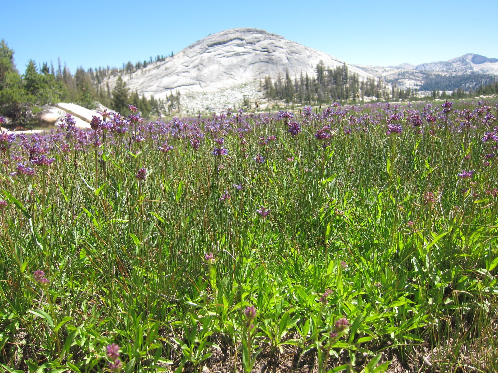
I only went out for a walk and finally concluded to stay out till sundown, for going out, I found, was really going in.


31 July 2010


The night wasn't as cold or as windy as I was expecting it to be. But it WAS a busy night, as peak baggers were passing us as early as 2am to get to the top. (I'm not sure what good doing that was, as the sun wasn't going to rise for a few more hours).

No one bothered us or told us to move. Some even apologized.

I felt my thighs this morning and was glad that I didn't feel the need to get up at oh-dark-thirty for the ascent. But when Abid got up for his climb after sunrise, instead of me heading down to the eastern base camp to wait for him there, I opted in the last minute to join him for at least the first mile. That turned out to be an ascent all the way to the top afterall by 6:30am.

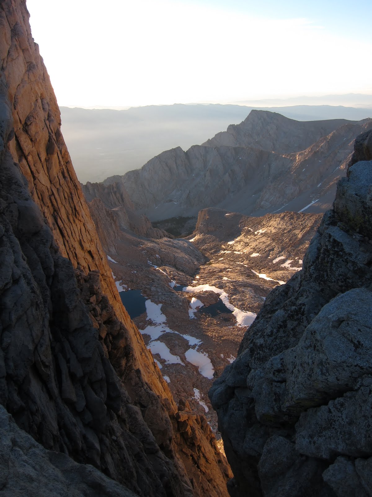
The rising sun poked its rays from between the crags, but the colors weren't as vibrant as I thought they would be. When I got to the top the colors were already washed out by the haze and Abid was chatting with the three Maryland boys. The views were no more stellar than they were the night before.

"How was the sunrise?" I asked the photographer in the group.
"OK" he answered. So I wasn't the only one unimpressed with the sunrise.

Abid joined the Maryland boys, bartering chocolates for cigarettes. He seemed to crave nicotine now. I didn't listen to all that he chatted about and meandered around the summit for unique vistas. The view this morning was no different than the view last night: I had a grey granite panorama of peaks and crags.

I was cold now, having kept my down jacket and hat on for the ascent. I kept them on even after the sun had risen higher in the sky. More people were coming up, the summit no longer kept me in a trance, and I was ready to get back down and make room for other people.

"I have a hard time concentrating when I am congested" said Abid as we walked downhill. What brought up that thought? We were in the protective zone and were not allowed to use the bathroom here. Apparently I wasn't the only one "holding it in."

Thanks for sharing, Abid. He also asked me more philosophical questions such as do I think beautiful women are more stuck up than ordinary women. Yes. Men will always be attracted to beautiful women, but beautiful women will also get them in trouble. Beautiful women will also stray more out of a relationship. He also added that men who already have children should have their penises cut off (!). What, pray tell, brought on that thought?

"My wife is not very pretty, but she has a beautiful soul and is a great mother." I listened to his stories of his wife and children --he has five--with the youngest only two years old.

"Sounds like you need your penis cut off!" I replied back to Abid.
"Oh no!" So I caught him in a minor hypercritical reply.
Luckily our conversations mellowed back to normal once we were around others again.

We met Ryan on our way down. It only took him 30 minutes to climb up the switchback.
It was the last we saw of him, too.

The line of "other people," however, didn't subside. Mount Whitney was being attacked by a long line of day hikers coming up from the eastern slope. One could see the human train slowly move up the switchback. Some looked like they had no business attempting this strenuous hike.

The JMT was now officially over for me once I bagged Whitney the night before. Abid, however, took the opportunity to meet all the people coming up. The man has the gift of gab and can turn any trivial chat into a meaningful conversation. Today, however, I wasn't in the mood. I wanted to get down from the mountain.

"How long you think it will take us to get to Portal?" asked Abid.
"We should be there between three and four this afternoon," I replied. That still seemed so far away. We still had this human traffic jam to overcome.

"How much further to the top?" several exhausted hikers asked me. What I wanted to know was how much longer to the end?! Going down Whitney was no easier than going up it.

I stopped to take off my cold-weather gear, rested briefly just off the steep switchback, and by the time I was back on the trail fighting uphill traffic going the opposite direction, I lost Abid for the rest of the hike. He kept getting further and further from me. I had no energy to catch up with him.

My feet were now hurting. After 18 days of painless hiking, my leather Lafuma boots felt heavy, hot and tight around the toebox in both feet. No resting, no amount of water or snacks could get my energy back for me or my feet from hurting. These last eight miles to Whitney Portal were a silent haze, filled with nothing but steep granitic switchbacks.

A little pica nibbled on some leaves while under the protection of some rock slabs, completely oblivious to my presence. This little rodent was perhaps the one joy of the morning. It let me come up close to it before it scooted back into the darkness of its den.

To make matters worse, since I was in the protective "Whitney Zone" that meant I couldn't just run behind some shrubs and use the bathroom. I had to use a special WAG bag for human waste. It was a very unsatisfactory experience. What made this so bad is also having to carry that WAG bag in my backpack. The sealed contents did not smell too rosy...

I was soon far enough away from Whitney that I lost the view of the peak. The lower elevation trail was still mostly rockfall, but three miles from the exit the trail turned into an inviting, pine-studded trail. I was now seeing families again, overweight people and women dressed more for a fashion runway than for a trail as they walked toward Lone Pine Lake.

This canyon was long, steep and narrow. Why would anyone want to hike up Mount Whitney from this end? (Answer: all those not wanting to do it from the JMT!) I could see a paved road and the small town of Lone Pine from the distance, but the town never seemed to get any closer.

I made it to the parking lot at 3:20pm, within my estimated time. So this was it! I saw the Whitney Cafe I had heard so much about, where thru-hikers gather for a beer and cheeseburger. That is exactly what I wanted. Abid was already there and had been there for almost an hour. He had found his MoJo, he said, and kept on hiking.

And naturally he had found some people he could talk with. Some of the men were drivers looking for people like us they could drive into Lone Pine for a nominal fee of $20 each person.

We sat outside at a picnic table. I was famished and ate the cold remainers of some French fries. I also took my heavy boots off and sure enough, found two hot spots on each foot. Abid said he was going to order my cheeseburger but instead kept chatting with the guys to the point of annoying me; I should have gone inside first thing and ordered my own meal. It was the only time I lost patience with him.

So this was it. After 19 days of ups and downs along the trail, two storms and one involuntary water dunking, it was all over. Just like that. There was no ticker tape parade, no cheers, no final hugs. The John Muir Trail was over for me.

Now I just had to get back to my van, resupply and finish the last 23 miles. Getting back to Yosemite was now my next destination.